Navesink Military Reservation
Hartshorne Woods Park

A Natural Fortress
With an elevation of 266 feet at Mount Mitchill, the Navesink Highlands peninsula in the northeastern corner of Monmouth County is the highest formation on the East Coast between Maine and the Yucatan.
The park lies at the southeast corner of the peninsula, which is bounded by Sandy Hook Bay on the north, the Shrewsbury River on the east, and the Navesink River on the south. For the defense of New York Harbor during WWII, a U.S. Army General called the Highlands “a natural fortress.”

During WWI the Army had installed a 12-inch mortar battery on the Highlands south of Twin Lights, and in March 1941 the Site Board for the Harbor Defenses of New York recommended the “Highlands of Navesink” as a “natural fortress” for Fort Hancock’s new armament.
The elevation of the Highlands would enable the use of a Depression Position Finder for vertical triangulation of targets and Case II firing over the water. The location would enable the guns to cover the entrance to New York Harbor and the New Jersey landing beaches and water area up to the Shark River Inlet, about 15 miles to the south. The elevated site would also be easier to defend against an enemy land assault than a site located on the shore.

The Corps of Engineers designed the batteries to withstand 2,000 lb. aerial bombs.

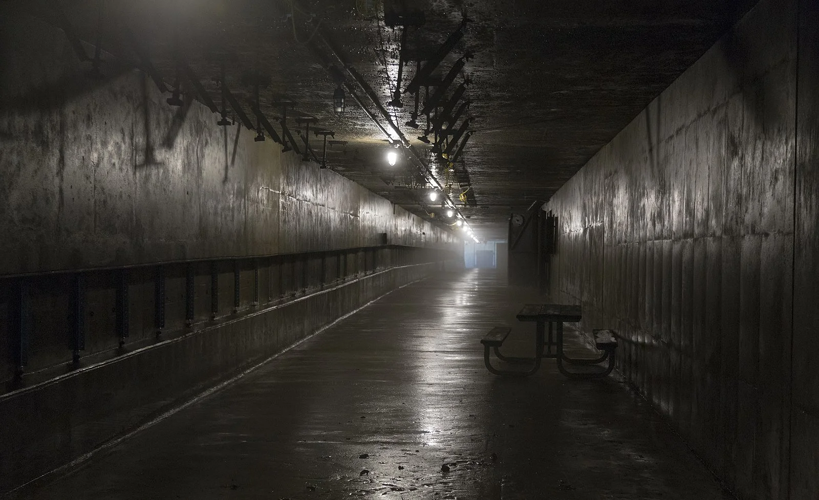
The ceiling of the Front Corridor and adjacent rooms consists of a 4.5-feet high Structural Roof topped by an 8-feet high Protective Roof, for a total of 12.5- feet of concrete protection (See Photograph 0003). There is approximately 8 feet of earth above the concrete.
From the northwest corner of the parking lot near the main Reservation entrance, the Park’s Bunker Loop Road extends southwest into a ravine with the Battery Lewis Plotting-Switchboard Room (PSR) (See Locator Image 4-5). The Army built this road in 1942 and designated it as Access Road “G.” A short connecting road was subsequently built from Grand Tour Road to the top of Access Road “G.” The MCPS designated Access Road “G” as the Bunker Loop Road. An 1875 Hartshorne family map outlines a “Cranberry” area in the vicinity of the Plotting-Switchboard Room, possibly suggesting a former cranberry bog in this location.


The Corps of Engineers cited Battery 219 at an elevation of 150 feet on Rocky Point on the Navesink Reservation.
its two 6-inch guns could protect New York Harbor and the North Jersey coast from ships and landing craft.
With an elevation of 266 feet, Mount Mitchill on the north side of the Highlands is the highest elevation on the continental east coast between Maine and the Yucatan. The Highlands has long been a landmark for navigation to New York Harbor past Sandy Hook to the northeast. The Navesink Twin Lights, built by the U.S Government in 1862 at a base elevation of around 200 feet, are located in Highlands, N.J., about 1,800 feet north of the Reservation.
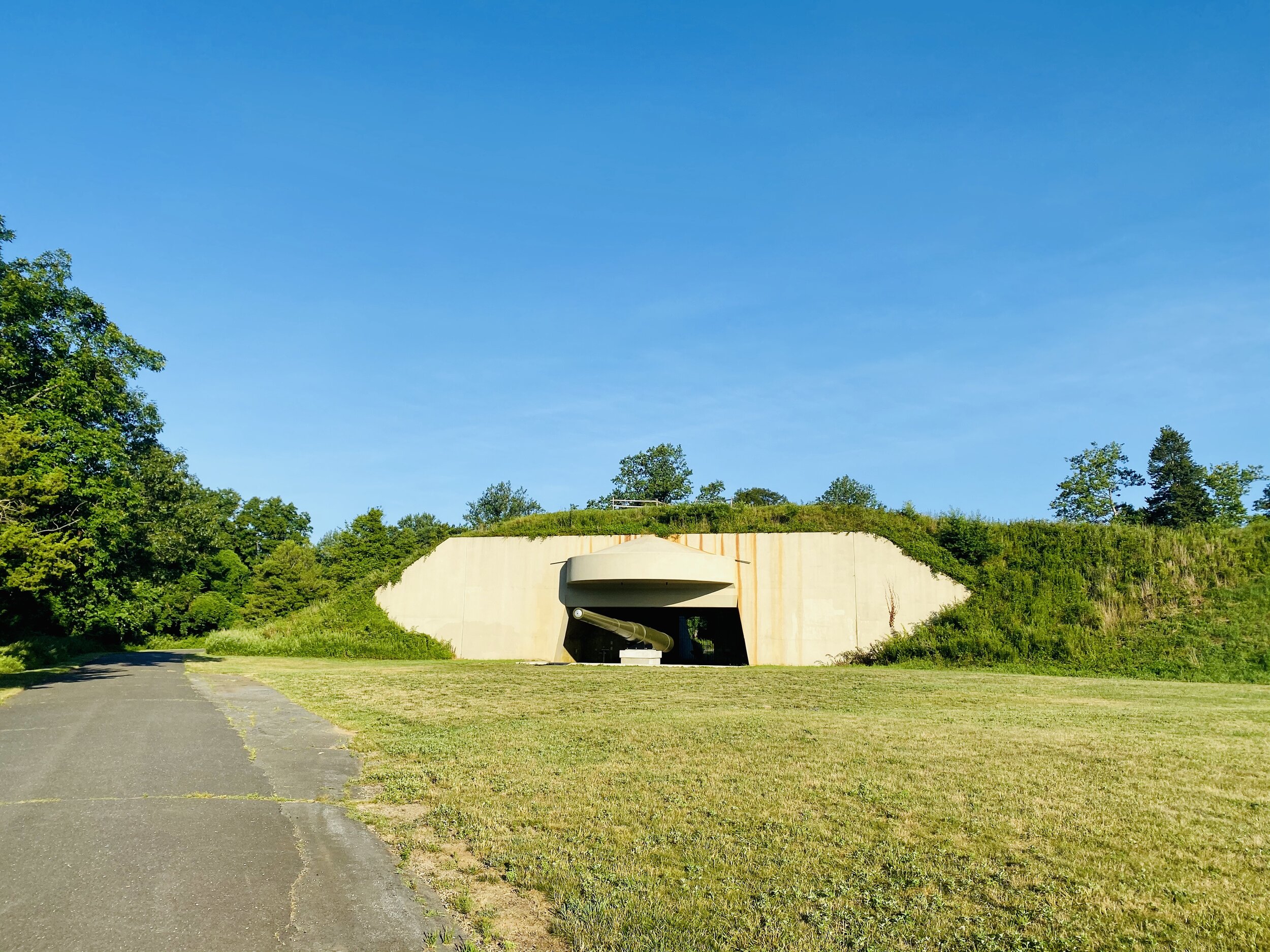
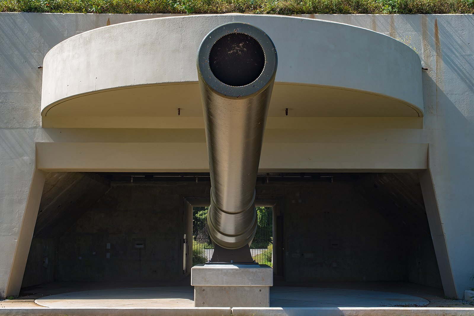
Also known as Battery Construction Number (BCN) 116, Battery Lewis is a massive concrete, steel and earth-camouflaged gun fortification measuring approximately 614-feet long, 158-feet wide, and 35-feet high (See Photographs 0002-0005). The sloped earth that forms the sides and top of the Battery gives the appearance of a long mound bulging in the center and at the ends. Small shrubs, grasses, and other low plants cover the mound, along with a few trees on the southwest side. A pathway extends from the northeast side of the Battery across the top with a loop to the north end, and the tops of ventilation shafts are visible along the pathway. The elevations of Battery Lewis are approximately 215 feet at the base and 240 feet at the top.
The Corps of Engineers cited Battery 219 at an elevation of 150 feet on Rocky Point on the Navesink Reservation so that its two 6-inch guns could protect New York Harbor and the North Jersey coast from ships and landing craft.